Resources
Discussion Papers
Abercrombie Lecture: Spatial planning reimagined - rekindling the founding spirit for the future (2024)
This paper reviews the lifetime achievements and unrealised visions of Sir Leslie Patrick Abercrombie to stimulate discussions on the unprecedented challenges and opportunities facing the field of spatial planning. By revealing the founding spirit of the profession – compassion, selflessness and creativity –the author argues that the need for change is both external and internal. Thus, planners need to make behavioural changes within the profession to meet the demands of the future. The paper outlines various actions and strategies for the systemic transformation of spatial planning, including rebuilding the creativity and civic support pillars, equipping planners with adequate capabilities and skills and implementing methodological changes. Additionally, the paper introduces the vision of the newly formed Digital Task Force for Planning, which aims to harness the power of digital technology and scientific innovation to modernise the profession. Ultimately, the paper encourages planners to be proactive in adapting to a rapidly changing world and to pave the way for a more confident, creative and impactful profession for the future.
The Digital Transformation of Planning (2021)
This editorial sketches the development of the digital revolution from the early invention of the digital computer and the way urban planning has responded to various developments over the last 70 years. It poses the problem of how the planning profession might address the digitisation of society suggesting there are three parallel waves of activity which planners need to embrace: the traditional development of new digital tools and methods; the development of digital automation with respect to the functioning of cities through the smart city concept; and the widespread transformation of society in terms of ‘platform urbanism’ where new functions based on data and IT are beginning to restructure and disrupt traditional ways of how cities function .
Digital Planning: A Time of Change (2021)
The team at the University of Manchester who are key in developing new methods of research using digital technologies as well as developing research into digital transformations in cities have produced a short and pertinent statement of the issues that the Taskforce will address. As a group, they engaged in a round table discussion during lockdown in response to the setting up of the Taskforce. You can get access to their statement here.
Useful Resources

The UN's Roadmap for Digital Cooperation (2020)
As the world grapples with the coronavirus disease (COVID-19) pandemic, it is witnessing first-hand how digital technologies help to confront the threat and keep people connected. Supercomputers analyse thousands of drug compounds to identify candidates for treatments and vaccines. E-commerce platforms prioritize household staples and medical supplies, while videoconferencing platforms enable education and economic activity to continue. At the same time, the technological challenge posed by COVID-19 has been tremendous. While accurate data and information related to the disease are fundamental for an effective response, social media have been misused by some to spread dangerous misinformation and fuel discrimination, xenophobia and racism. Cyberattacks on the World Health Organization, hospitals and laboratories endanger lives and jeopardize potential advances in responding to and preventing the virus. A balance has to be struck between the use of technology and tracing applications to combat the spread of the virus and the safeguarding of privacy and individual rights …..
The Royal Society's Digital Technology and the Planet (2020)
Urgent, sustained, collective action is needed in order to address the global climate emergency. As communities across the world recover from the COVID-19 crisis, efforts to reignite economies should be harnessed to accelerate the shift to a net zero economy and society. Digital technologies have already transformed the economy. Digital services have revolutionised communications and made it possible for a large part of the economy to continue to function during the pandemic. Data-enabled technologies such as machine learning and artificial intelligence have also enabled efficiencies and optimisation across sectors. While some of these applications already contribute to reductions in greenhouse gas emissions, digital technologies also have an environmental cost which should not be neglected – from the extraction of minerals to the energy use and emissions of the technology. Under the right conditions, digital technologies could optimise and reduce their own footprint…
UCL New Urban Agenda: New Urban Analytics (2019)
There are many initiatives being developed by government and the private sector which essentially are beginning to automate the work of local authorities and related agencies in terms of new information technologies. The landscape for the introduction of these new services and activities is complex and difficult to navigate. In this report, Janice Morphet and Robin Morphet lay out this landscape, providing a road map so that we can explore what is happening, first in general terms and then more specifically with respect to what is happening in the UK. A project funded by the Macarthur Foundation dealing with Urban Informatics and the Smart City developed at the Centre for Advanced Spatial Analysis in UCL.
UN Habitat Cities and Pandemics: Towards a More Just, Green and Healthy Future (2021)
We need to address systemic poverty and inequality in cities head-on, going back to housing, basic services, mobility and connectivity. We also have provided recommendations on how to adopt rights based principles to recovery. This also means protecting jobs and providing financial support to cities to allow them to create financial resilience. We must not forget digitalisation that has created two realities: one for those online and another for those offline. We provide recommendations on creating greater and more equitable digital opportunities that are ever more important in the “new normal” as we learn to live with pandemics.
Finally, let us stress the importance of greater multilevel coordination between international, national and local governments, especially when investing in and implementing stimulus programmes, so that we can truly build back better, greener and fairer while also protecting our communities. This report provides recommendations on how to do this at regional, city, neighbourhood and building scales. These recommendations provide the basis for better integrated spatial development planning as well as demonstrate the value of multilateralism when tackling a global pandemic locally.
The Charter of European Planning (2013)
Europe needs cities and regions which are strong and good to live in. Spatial Planning is therefore vital to the future for Europe. In particular, it helps sustain our shared resources of land, air and water which are subject to ever-increasing development pressures. This requires effective planning if Europe is to have sustainable economic development and fair and just societies. The particular strength of Spatial Planning is its ability to deliver the opportunities and counter the threats that arise from new development. It is therefore long term in its perspective but urgent in its actions. The principles set out in this Charter of European Planning need to be embraced by all those within government, local authorities, agencies, civil society, NGOs and the private sector. This Charter therefore provides a common point of reference for all those with responsibility or power over the future of Europe’s cities and regions.
The RTPI's Place-Based Approaches to Climate Change (2021)
Climate change is one of the grand challenges of our times. Together with the related challenges of aging, housing, mobility, migration and ethnicity, the digital revolution can make a real impact on our abilities to forecast and see the future, engaging us to reach out for the goals of net more effectively zero. This paper Isabella Krabbe advocates for a place-based approach to the climate and ecological emergency, exploring how in house collaborative working across local authority departments deliver place-based approaches to the climate emergency. A particular focus is given to joint working between planners and climate and sustainability officers to demonstrate how a consideration of climate change can be mainstreamed in planning and vice versa. The report reflects briefly on the ongoing challenges in delivering place-based climate action.
Newcastle's System of Systems (2018)
Newcastle City Futures commissioned Urban Foresight to undertake a ‘system of systems mapping.’ This report summarises this analysis, describing the various systems that operate in Newcastle and planned developments in urban services and infrastructure networks across the city. This supports the ambitions of Newcastle City Council and its partners, who see a smart and connected city as an opportunity to radically transform the delivery of public services and infrastructure. This is motivated by achieving better outcomes for citizens, cost savings, operational gains and the economic benefits from positioning Newcastle as a globally recognised digital destination and tech hub. The report sets the context for this ambition, summarising past accomplishments and introducing a vision and principles to guide future progress. Key challenges and opportunities are identified which draw on a detailed audit of systems, which is summarised in the Appendix. Finally, five key recommendations are set out to help deliver a successful smart city programme and to realise the significant benefits that this could deliver.
The National Infrastructure Commission's Data for the Public Good (2016)
The more information we have about the nation’s infrastructure, the better we can understand it. Therefore, data is crucial. Data can improve how our infrastructure is built, managed, and eventually decommissioned, and real-time data can inform how our infrastructure is operated on a second-to-second basis. Sharing data can catalyse innovation and improve services. Transport for London (TfL) has made information on London’s transport network available to the public, paving the way for the development of apps like Citymapper, which helps people get about the city safely and expediently. But it is important that when information on national infrastructure is shared, this happens with the appropriate security and privacy arrangements.
Our report sets out clear actions in three areas: collecting the right data; setting standards for data; and sharing that data securely. These actions can improve services whilst saving society billions of pounds.
Liverpool's Building Data Ecosystems to Unlock the Value of Urban (Big) Data (2020)
As elsewhere, civic leaders (CLs) in Liverpool City Region (LCR), including and in particular Liverpool City Region Combined Authority (LCRCA) and its six constituent local authorities, are alert to the possibilities presented by computing power and data-driven solutions to critical economic, social and environmental challenges, and to the reality that at the centre of any high-performing ‘Smart City’ Region must be a high-performing data ecosystem. Accordingly, CLs in LCR are now striving to develop such an ecosystem to enable stakeholders to more effectively exploit the latent value inherent within local datasets, and datasets with local expression.
The NIC's Anticipate, React, Recover: Resilient Infrastructure System (2020)
The National Infrastructure Commission provides the government with impartial, expert advice on major long term infrastructure challenges. Its remit covers all sectors of economic infrastructure: energy, transport, water and wastewater (drainage and sewerage), waste, flood risk management and digital communications. While the Commission considers the potential interactions between its infrastructure recommendations and housing supply, housing itself is not in its remit. Also out of the scope of the Commission are social infrastructure, such as schools, hospitals or prisons, agriculture, and land use. The Commission’s objectives are to support sustainable economic growth across all regions of the UK, improve competitiveness, and improve quality of life.
The Geospatial Commission's Planning and Housing Landscape Review (2021)
Geospatial data, or location data, comprises attribute data that is tied to a specific location. Overrecent years there has been a huge increase in the volume and quality of location data that can be gathered and combined with other sources of information, helping inform decision making. The recent Geospatial Data Market Study highlights how the UK geospatial data market has been transformed through the evolution of data collection mechanisms. Following the publication in 2020 of the UK Geospatial Strategy, and the National Data Strategy, the Geospatial Commission is leading a Planning and Housing programme that seeks to ‘unlock’ economic and social value through better use of geospatial data. This includesinterventions to improve the accessibility of geospatial data, and the capabilities, skills and awareness. The Geospatial Commission engaged Newgate Research in 2020 to undertake a Planning and Housing Landscape review to provide a baseline understanding for the field. Here is their report.
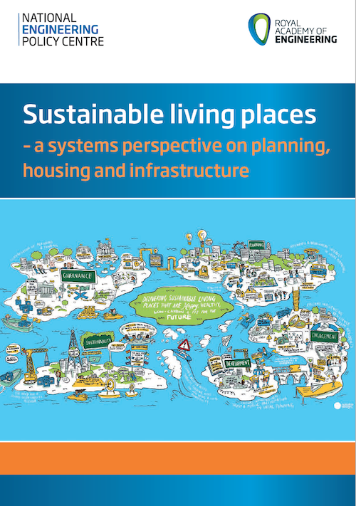
The Royal Academy of Engineering: Sustainable Living Places
The Royal Academy of Engineering took the decision to establish a project on Sustainable Living Places following fruitful discussions with the Infrastructure and Projects Authority (IPA). We set up a working group of experts, to explore how this thinking might be applied to housing in the UK, a complex challenge, with social, environmental and governance issues. The first question we asked ourselves in the working group, was to what extent a system of systems (governed by less rational factors than physics), might be amenable to a systems approach. The second question was whether the main actors in this system, traditionally unaccustomed to engaging in a conversation with engineers, would welcome input and advice from the Royal Academy of Engineering. Fortunately, the answer to both questions was a resounding yes. If we are to navigate a path through this complex landscape, it is essential that we have a good map within which to take our bearings. This report sets out to start a process of mapping. Working with a large and diverse group of stakeholders the authors have drawn a very broad boundary around the challenge of delivering sustainable living places. The map is more than just an aid to navigation. It also identifies leverage points – the places where policies can hope to exert the greatest effect.
The Deloitte Smart Cities Report
Smart cities exist on the intersection of digital technology, disruptive innovation and urban environments. They are an exciting place to work and live and the breeding ground for new ideas. This report is intended to be a living document. New releases of this report will be issued frequently to reflect advances in technology and new examples of smart solutions Check www.deloitte.nl/govlab